Description
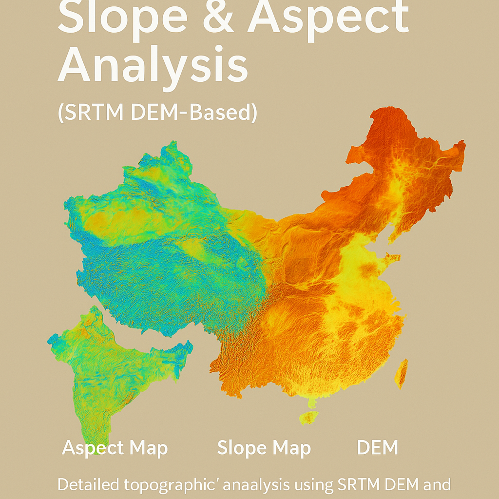
This product provides high-resolution topographic insights into China’s terrain by generating slope and aspect maps using the Shuttle Radar Topography Mission (SRTM) DEM. Utilizing the powerful cloud-based geospatial platform Google Earth Engine (GEE), this analysis computes and visualizes:
1. Aspect Map:
Aspect represents the compass direction that a slope faces. It is useful in:
-
Hydrological modeling
-
Solar radiation analysis
-
Land use planning
-
Agricultural zoning
The aspect values are visualized with a color palette ranging from blue → green → red representing different directional orientations (0° to 360°).
2. Slope Map:
Slope is the measure of steepness or incline of the terrain. This is essential for:
-
Landslide risk assessment
-
Infrastructure planning (roads, buildings)
-
Soil erosion studies
-
Agricultural machinery feasibility
The slope values are visualized from 0° (flat) to 90° (vertical) using a palette from black → yellow → orange → red, highlighting elevation gradients.
3. Digital Elevation Model (DEM):
The raw elevation data clipped to China’s boundary is also visualized for contextual understanding. The elevation is styled using a terrain color scale (black → light green → brown).
📤 Deliverables:
-
High-quality GeoTIFF files of Slope and Aspect layers (30-meter resolution)
-
Ready-to-use outputs for GIS applications, modeling, or environmental analysis
-
Exports available directly to your Google Drive
-
CRS: EPSG:4326 (WGS 84)
🔍Use Cases:
-
Environmental Impact Assessments (EIA)
-
Solar farm site selection
-
Forest and watershed management
-
Risk zoning in mountainous regions
-
Terrain modeling for real estate and infrastructure
📂 Technical Workflow Summary:
-
Load China’s administrative boundaries from FAO GAUL.
-
Import NASA’s SRTM 30m DEM.
-
Clip the DEM to China’s boundary.
-
Generate and visualize Aspect and Slope using GEE’s
ee.Terrainfunctions. -
Export the results as GeoTIFFs for offline use or integration in GIS software.
Reviews
There are no reviews yet.